DIY Freeze-Dried Backpacking Meals: Pros & Cons of Freeze-Dried Food + DIY Menu Ideas

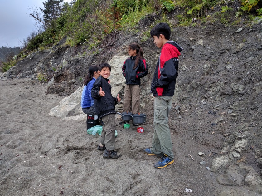
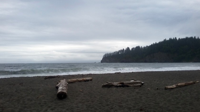
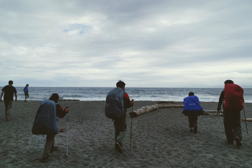
The countdown for our summer trip is on! Adding to our excitement, we recently learned that we were granted a 4-night permit to backpack 41-mile Rae Lakes Loop in Kings Canyon National Park. After visiting Sequoia/Kings Canyon and Yosemite in 2014, we’d hoped to return to explore the beauty of the High Sierra someday. We’re thrilled to finally have the opportunity to backpack both Rae Lakes and a 31-mile segment of the John Muir Trail this summer! Wilderness permits were even more competitive than I’d anticipated: with only 40 people allowed to enter the trail per day, we emailed our application in one second after the 12 am opening for permit applications for the season and didn’t receive our first choice route. It’ll mean hiking Glen Pass and Rae Lakes in a steeper counter-clockwise direction, but I have no doubt that the achy quads will be well worth the pain.

IMG_20140624_161548
Yosemite Valley, as seen from Glacier Point 2014
IMG_20140622_145012
View from atop Moro Rock, Sequoia National Park–can’t wait to explore Kings Canyon’s beautiful backcountry this summer!

With wilderness permits and campsite reservations out of the way, our focus has shifted to food. Namely, how do we plan and execute meals for a 7,000-mile road trip with 20 nights of backpacking and 20 nights of car camping? Factor in 1) flying in from Hawaii with backpacking gear and 2) renting a compact car, and the challenge becomes clear. Space and weight are at a premium, as are time and money. Throw in food preferences and dietary sensitivities, and the challenge compounds. Your food considerations may differ, and that’s okay. My intent is not to push some personal agenda, but rather to consider the factors driving our decision and share some food ideas that I hope you might find useful wherever your travels may lead you.  

Space: With backpacks holding our clothes, tents, and camping gear, any remaining items must fit into 2 carry-on suitcases when we fly. Are additional or larger suitcases options? Sure. But each additional suitcase means less space in an already compact trunk and more luggage to keep track of at the airport and on the road. In an effort to keep our packs manageable, we’ve streamlined our travel wardrobes: 3 short-sleeved tech/merino tops, 1 long-sleeved performance top, 2 pairs hiking pants, 2 pairs of sock liners, 3 pairs of socks, 1 thermal base layer set, 1 fleece pullover, 1 rain jacket, and 1 puffy per person. I realize this list may sound austere for 45 days, but handwashing clothes nightly saves us space and weight, enabling us to dedicate 2 carry-on suitcases to food…which brings us to factor #2. 

IMG_20140624_160905
The view from Glacier Point, Yosemite…this time from a slightly different angle. We’re excited to hike to Thousand Island Lake in the Ansel Adams Wilderness this year!

Whole Food/Dietary Preferences: Could we exclusively purchase fresh whole food on the road and keep everything chilled in a cooler? In theory, yes. But experience has taught us (and again, this is just us) that buying a hard-sided cooler upon arrival means spending inordinate amounts of time and money on ice maintenance. Our itinerary has us in the desert for three weeks, and keeping raw chicken and eggs cold in triple-digit heat is a tough proposition without a Yeti (it’s on our wish list, though!). Entirely possible–but not something I’m keen on focusing my energy on.

Without refrigeration, our food options are limited. There’s processed/canned food, oft vilified but not without its merits: shelf-stable, convenient, and imminently available. This is not insignificant considering that the bulk of our itinerary will take us through small towns with limited grocery availability. But while I’m not opposed to an occasional processed meal (I crave junk with the best of ‘em!), I know from experience that extended junk consumption affects my mood, performance, and morale. Similarly, our standard salami and cheese hiking fare tends to weigh me down after 2 weeks. For an extended 45-day trip, I wanted to stick closer to our everyday protein staples–nuts, beans, hummus, chicken, fish, and tofu. I also wanted to maintain our veggie and fruit intake and limit MSG and processed items.  

But how to circumvent the lack of refrigeration? DIY dehydrated meals sounded ideal, but with zero backpacking opportunities here on Oahu, the investment vs. return in terms of startup costs (dehydrator, vacuum sealer, O2 absorbers, mylar bags, etc) would leave us in the red for a few years. Freeze-dried food began to pique my interest.

PANO_20140622_144830
Moro Rock, Sequoia National Park 2014

Time and Money: For better or worse, being a compulsive itinerary-crammer means we’re often scrambling to find grocery stores and shopping under the gun in order to maximize time at destinations. And while I’ve mentioned that it’s important for us to limit expenses by cooking meals on vacation, what I didn’t mention is this: I enjoy cooking at home, but I don’t love cooking on vacation, especially after a long day of hiking. I love that other people enjoy gourmet experiences in the backcountry, but I’m not fond of fiddling with ingredients and spices on the trail. Chopping and cooking when tired is a surefire recipe for one hangry mom!

Fortunately, companies like Mountain House and Backpacker’s Pantry offer delicious freeze-dried meals with just-add-boiling-water convenience and significant time and fuel savings. They’re shelf-stable, lightweight, and compressible, making them ideal for bear canister storage as well. However, that convenience comes with a hefty price tag. At over $6 per person, I couldn’t justify the cost for 20 nights, let alone 45. I wasn’t keen on the high sodium content and additives, either. DIY freeze-dried meals started sounding like a more viable option for us.           

Backpack Space and Weight: Finally, we have several 3-5 day treks that require bear canisters (space). Given the base weight of packs and gear (20 lbs for adults, 10 for kids), we anticipate 20-35 pounds per person with food. With the kids under 90 lbs each, we wanted to keep our food as light as possible. DIY freeze-dried meals seemed to offer the best opportunity for lightweight, shelf-stable, mostly healthy food with time and money savings.

IMG_20140623_155015 (1)
We absolutely loved Yosemite Valley and can’t wait to hike a portion of the JMT near Tuolumne Meadows!

Luckily for us, there’s a wealth of DIY freeze-dried meal information to be found online! Most sites recommend assembling freeze-dried/powdered ingredients in freezer bags for ease of “cooking” (add boiling water and seal for 5-10 mins), so we’ll likely be going that route in addition to simply rehydrating meals in a communal pot.

Are there drawbacks to freeze-dried food? Absolutely. For one, freeze-dried ingredients are not readily available in retail stores. For us, this meant having to plan and order 6.5 weeks worth of food months in advance. The upside, however, is that I was able to scour Amazon and wait on the best deals. Ordering food in advance also gave me an accurate handle on our food costs–a budget area that’s generally grayer than I’d like for trips. Also, there’s no denying that freeze-drying is a type of processing in and of itself, and natural/organic options are limited. The whole grains and fiber we crave don’t always translate, either, but I’m okay with these tradeoffs. Will we still be stopping to pick up fresh fruits and veggies weekly? Definitely. Will we break down and buy a cooler at some point? Very probably. Does our menu include processed food? Some. But I feel satisfied knowing that the bulk of our food needs are covered in a way I’m mostly comfortable with.

Road Trip 2017 includes menu items like: (* indicates freeze-dried/powdered items)

  • BREAKFAST
    • Granola, blueberries, and powdered milk/soy milk*
    • Oatmeal with blueberries, walnuts, and chia seeds*
    • Scrambled eggs*
    • Tortillas with eggs, bacon and cheese*
    • KIND bars, Larabars, ProBars and the like

      IMG_20170508_100736
      A sample of our breakfast items: cheese powder, egg powder, peanut butter powder, powdered milk, freeze-dried blueberries, single-serve SPAM and Nature’s Path Oatmeal. We also ordered powdered soy milk and will buy granola once we arrive.
  • LUNCH (we prefer not to cook at lunch; when we’re not backpacking, lunch also includes whole fruit)
    • Whole wheat/spinach tortillas or bagels with pouch tuna or chicken
    • Seeded crackers with pouch tuna or chicken
    • Pita and hummus with cucumber, carrots, bell peppers
    • Whole banana rolled in PB whole wheat tortilla
    • PB with seeded crackers/pita/tortilla* and veggie sticks
    • Hummus and seeded crackers with veggie sticks
    • Bagel with pouch salmon and cream cheese
    • Pita with tomato paste, pepperoni, and cheese
    • Trail mix alone or eaten with PB, Honey Stinger waffles

      IMG_20170508_092905
      Some lunch protein options: dehydrated refried beans, peanut butter powder, shelf-stable hummus, PB/almond butter packets. We’ll pick up seeded crackers, tortillas, and tuna/chicken/pepperoni after we land
  • DINNER (based on personal taste preferences)
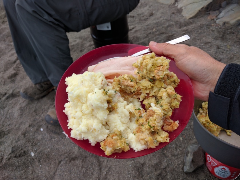
    • Parmesan couscous or cheesy polenta with chicken and veggies*
    • Refried beans, rice, and cheese (with/without tortillas)*
    • Angel hair pesto pasta with chicken and veggies*
    • Soba/udon noodles in miso broth with shiitake, shelf-stable tofu and wakame*
    • Mock fried rice with veggies and chicken*
    • Peanut rice noodles with chicken and veggies*
    • Jambalaya with chicken, rice, and summer sausage*
    • Curry couscous with chicken and veggies*
    • Thai/Japanese curry with shelf-stable tofu, veggies, and rice noodles*
    • Orzo n cheese with broccoli and tuna*
    • Chili chicken rice with veggies*
      IMG_20170508_100057
      A sampling of our dinner ingredients: freeze-dried chicken, freeze-dried veggies, udon noodles, natural chicken base, freeze-dried cilantro, Sriracha, soy sauce, peanut butter, non-MSG fried rice seasoning blend, tonkatsu sauce for flavor

      IMG_20170508_095123 (1)
      Also on the dinner menu are: refried beans, wakame, miso paste, and spring roll rice wrappers or rice noodles (whichever is available once we land). All starches, shelf-stable tofu, and summer sausage will also be purchased after we land

We’ll supplement daily with hardier veggies and fruits that can withstand backpack and car wear-and-tear sans refrigeration. Thankfully, carrots, sugar snap peas, celery, cucumbers, bell peppers, apples, oranges, pears, and bananas all fit the bill here. We’ll buy yogurt where available to keep our digestive tracts humming. Also, gross as it may seem, you know the menu has to include at least a little SPAM as an homage to our island roots. 😀 Fresh shrimp/sausage/corn hobo packets on market days and Idahoan Loaded Potatoes in the backcountry are also likely to make a dinner appearance or two. All things in moderation, right?

IMG_20140623_130422
We love fresh fruit on day hikes. Apples, pears, and oranges are especially hardy and do well without refrigeration. Bananas and grapes are a little more delicate but always appreciated.
IMG_20170508_092658
We stocked up on four bags each of these freeze-dried fruits and veggies as fresh produce is generally weight-prohibitive on multi-day treks. Freeze-dried produce is lightweight and fits easily into bear canisters if repackaged into Ziploc bags 

Many of our dinner recipes were inspired by freeze-dried meal recipes found on Pinterest. If you decide to go the DIY route, I highly recommend testing recipes at home first. Some ingredients and recipes took much longer to rehydrate than advertised–a definite problem at altitude with limited canister fuel. Others required flavor tweaking (again, just a matter of personal preference) or involved fiddly steps like mixing and frying dough (not my jam, but I bet a lot of people love it!). Testing recipes was also a tasty and fun solution for gauging proper portion sizes for our family. And for those who’d prefer to forgo freeze-dried ingredients altogether, substituting tuna or chicken pouches in place of freeze dried chicken is always an option, as is substituting pre-flavored sides, such as Near East Couscous, Annie’s Mac n Cheese, or Thai Kitchen noodles for any of the starches.     

My biggest food tip? Save condiment packets! They’re lightweight, easily packable, shelf-stable, and add infinite variety to your backpacking and camping meals. Here’s a short list to get you started:

Condiment Ideas:

  • Ketchup
  • Mustard
  • Relish
  • Salt and pepper (Available at diners, movie theaters, and gas station food marts)
  • Mayonnaise (Less readily available–I found these at theaters and gas station food marts)
  • Soy sauce (Chinese/Japanese takeout)
  • Hot sauce (Sriracha, Tapatio, Tabasco, etc.; I found Sriracha on Amazon, and minimus.biz is another good resource for condiments)
  • Taco sauce (think Taco Bell or Jack in the Box)
  • Salsa (sometimes served with breakfast burritos)
  • Tonkatsu sauce (sometimes available in Japanese bento)
  • Jam/jelly (many diners carry these; my sister found them consistently at Denny’s)
  • Honey (this one’s harder to find in packet form except for places like KFC or Popeye’s, but it’s readily available in organic straws off Amazon)
  • Sweet and sour sauce/ BBQ sauce/Ranch/Honey Mustard/Sweet Chili containers (this one’s pretty specific to McDonald’s and other fast food places that serve chicken nuggets)
  • Olive Oil (I ordered these off Amazon to boost calories as needed)
  • Syrup (fast food breakfast chains are your best bet)
  • Red pepper packets/parmesan cheese (pizza/Italian takeout)
  • Hot mustard (Chinese takeout; Panda Express has a lot of these)
  • Wasabi (from sushi or poke takeout)

    IMG_20170508_094256
    Small sample of seasonings and condiments: non-MSG dashi powder, Creole seasoning, natural chicken base, tomato powder, freeze-dried cilantro, Sriracha, hot mustard, yellow mustard, jelly, ketchup, relish, soy sauce, mayo, and taco sauce. 

With the help of family and friends, we’ve been lucky to amass a nice condiment haul over the last few months. Fortunately, freeze dried food compacts well, leaving plenty of space for condiments in our 2 carry-ons. And anything that helps us stay on track for cooking our own meals helps to save time and money in the long run. For example, even though we’re fried rice fanatics, the mock fried rice we tested left us less than wowed. We found ourselves craving the oyster sauce umami punch that soy sauce alone lacks. Down the line, this might lead to abandoning the meal altogether for costlier restaurant fare or processed items. Adding hot mustard and soy sauce to the mix, however, instantly made the rice more interesting. And a packet of sriracha changed the flavor profile completely! With a few condiment packets and a little imagination, it’s possible to elevate any meal from ho-hum to crave-worthy. So, save those condiment packets–they definitely come in handy!
Do you have a favorite camping or backpacking meal? I’m always looking for new food ideas…I’d love to hear about your favorite food strategies and tips for camping and/or road trips!

More Than Meets the Eye: Wind Cave National Park and Mount Rushmore National Memorial

Prior to 2015, my impression of South Dakota was informed largely by bits and pieces I’d gleaned from the Travel Channel and a well-meaning Nebraskan friend. Corn, windmills, and biker rallies figured pretty prominently into the picture, as did tractors on highways and grasslands on steroids. Let me amend that: only grasslands on steroids. To hear my Nebraskan friend tell it, South Dakota comprised nothing more than 75,000 square miles of telephone poles and the very occasional crow.

“You’ve read Little House on the Prairie, right?” she said. I nodded, and she tossed her hands up in a you see what I mean? gesture. I thought she might at least concede Mount Rushmore as a worthy stop, but I quickly learned my lesson: South Dakota/Nebraska rivalry is a glorious, deep-seeded thing. Planning three days in South Dakota could only be perceived as a personal affront. “Have fun watching grass grow,” she huffed.

Here’s what I didn’t dare tell her: we could’ve spent three weeks in South Dakota and only scratched the surface of all that this beautiful state has to offer.

From Rocky Mountain National Park, we headed north, spending a day in Badlands National Park before bearing west towards Wind Cave National Park and Mount Rushmore National Monument. Already, we were enamored of the otherworldly terrain and wildlife of the Badlands, but before our three days were through, we’d come to love so much more about this underrated state. We were fortunate to stay at the Mount Rushmore KOA at Palmer Gulch, just ten minutes away from Mount Rushmore. We love in-park camping and had planned a week’s worth between Grand Teton and Yellowstone in the coming week, but I’m not ashamed to admit that I love a good KOA almost as much as the kids do. It’s the perfect camp/resort hybrid, and at $20/night for a tent-only site plus a $10 resort fee, this KOA measured head and shoulders above any commercial campground we’ve ever stayed at. But more on that later.

IMG_20150630_192708
Our home for two nights–Mount Rushmore KOA at Palmer Gulch was one of our favorite KOAs ever!

Palmer Gulch turned out to be a convenient home base for exploring Wind Cave National Park, a short 40-minute drive away. Wind Cave doesn’t receive nearly the attention that Carlsbad Caverns or Mammoth Caves does, and that’s a shame–it’s a fascinating place to visit. On first glance, it’s easy to dismiss Wind Cave as yet another example of the ubiquitous South Dakota grasslands my friend had warned us about, but this prairie harbors a secret world. Beneath the bison herds and prairie dogs peeking out from park burrows lies a 140-mile labyrinth of passageways that makes Wind Cave the sixth longest cave in the world. More significantly, Wind Cave houses 95% of the world’s known boxwork formations–thin calcite projections that form honeycomb patterns. 95%! True, I’d never heard of boxwork formations before visiting Wind Cave, but still. I know a significant thing when I hear it. 😀 

IMG_20150701_083721
Wind Cave National Park, 2015

Visitors may only enter the cave through a guided ranger tour, so we stopped at the Visitor Center to purchase tour tickets and Junior Ranger booklets. We opted for the 1.5 hour Fairgrounds Tour, which would allow us to explore both the upper and middle levels of the cave. NPS labels this tour as its most strenuous walking tour, but don’t let that deter you–participants navigate 450 stairs over two thirds of a mile in dimly lit conditions, but aside from the darkness, this tour is entirely doable for kids and adults of all ages. At $12 per adult and $6 per kid, the tour was reasonably priced, and we were excited to see what Wind Cave held in store for us.

A short elevator ride transported us from the Visitor Center into a dark and complicated maze of cave passageways. Outside, it was a blistering 100 degrees; here, beneath the surface, it was a cool 50–chilly enough to warrant a jacket. Moving from room to room, our ranger pointed out elaborate boxwork formations and illuminated iridescent frost formations with a flashlight. She warned us not to dawdle, and it soon became clear why: passageways forked into multiple passageways, which in turn divided into multiple passageways yet again–a mitotic explosion of cave confusion to the uninitiated like us. We ducked low boxwork ceilings in rooms barely large enough to accommodate a single body, only to turn the corner to enter gaping caverns where our voices echoed for what seemed like miles. It was an amazing study in contrasts. Our ranger ended the tour by extinguishing her flashlight to let us experience absolute darkness–the kind of darkness that made it impossible to see our outstretched hands not six inches from our faces. It was an incredible experience.

IMG_20150701_102423 (1)
Descending into the depths, Wind Cave Fairgrounds Tour
IMG_20150701_100444
Low boxwork ceilings meant frequent ducking and stooping
IMG_20150701_100512
Intricate boxwork in Wind Cave
IMG_20150701_110758
Maneuvering between narrow walls, glancing up at intricate formations
IMG_20150701_100504
Boxwork ceilings, iridescent frost formations as well
IMG_20150701_104520
Fairgrounds Cave Tour contains over 450 stairs, but it’s very manageable for families. Nothing sketchy or overly strenuous.

We ended our time in-park with a cursory nod to Wind Cave’s above-ground offerings, hiking 1-mile Prairie Vista Trail. Rolling plains, wallowing bison, and skittish prairie dogs set the stage for a hot but easy stroll through a sampling of the park’s bucolic setting. I would’ve loved to spend the rest of the day exploring Wind Cave’s hiking trails, but there was a KOA with resort amenities calling to the kids like Siren song. They’re good sports, always indulging my hiking and backpacking whims without complaint, so how could I begrudge them an afternoon of kid-approved fun? We drove back to our campsite and unleashed their boundless energy on Palmer Gulch.

IMG_20150630_145838
Prairie Vista Trail

Talk about amenities–this KOA was seriously decked out! Water slides, swimming pools, climbing walls, and a giant jumping pillow would’ve been ridiculous enough. But throw in a foam pools, life-sized chess, hayrides, horse rides, and bicycle rides, and you begin to understand why the kids couldn’t tear themselves away. They played hard all afternoon, finally collapsing at camp five hours later for dinner. We cooked our own meals, but this KOA even offers a pizza parlor, nightly barbecue buffet, and an ice cream shop for those who’d prefer to let someone else do the heavy lifting. For $20 a night, I can’t recommend Mount Rushmore KOA highly enough!

IMG_20150701_134652
Catching air–the kids loved this jump pillow!
IMG_20150701_141708
With all the activities that the KOA had to offer, it was a happy surprise to see them enjoying basketball together
IMG_20150701_143100
Our youngest had the best time riding around camp
IMG_20150701_155837
Slippery, soapy, foamy fun. Our youngest made fast friends with this little guy.
IMG_20150630_203553_1
Water slides, pools, and sprinklers provided relief from the triple digit heat
IMG_20150630_192731
Mini playground just feet from our campsite. The kids played here before every meal. The main amenities area had a much larger playground with sprinklers and a climbing wall.
IMG_20150630_192646 (1)
Hearty dinner for the famished fam

After dinner, we drove to Mount Rushmore National Memorial. If we had any question about the kind of crowds this great American icon draws, we had only to survey the enormous size of the parking lot–far and away the largest of any NPS site we’ve ever visited–to know the answer. This is not the kind of monument that’s hidden behind some grand facade, either; it doesn’t require hours of hiking to get to. In fact, from the moment you step onto the grounds (and for many miles before), you can see Mount Rushmore. But the experience of visiting Mount Rushmore? So much more than that. Walking through the parade of flags, watching the presidents’ faces sharpen in focus with each passing step–it’s an intentional process that transforms and elevates the experience into something unforgettable.

IMG_20150701_200450
Entering Mount Rushmore National Memorial–turnstiles
IMG_20150701_201026
Parade of flags–each state is represented here
IMG_20150701_200934
Mount Rushmore crowds are huge, especially in the summer. I never thought I’d love a crowd, but it really added to the patriotic swell of the lighting ceremony.
IMG_20150701_201122
A little piece of Hawaii in South Dakota
IMG_20150701_201322
Mount Rushmore at sunset, June 2015
IMG_20150701_201232
Sunset over Mount Rushmore. You can probably tell from all the gray–we got caught in some crazy thunder and lightning on the way back to camp!

Although we didn’t have enough time to hike any of the trails that would have brought us to the base of the carvings, we enjoyed browsing museum exhibits that cataloged the arduous task of bringing Mount Rushmore into fruition. Given a second chance, I’d definitely allot an entire day here, but if 2015 turns out to be my only experience at Mount Rushmore, I’m extremely grateful to have experienced the park’s evening program. Like everything else about South Dakota, the evening lighting ceremony was so much more than I expected. The sun set over the amphitheater, crowning the monument with a brilliant halo and then darkness. Floodlights illuminated the stage, drawing our attention away from the darkening monument. Through film, the ranger explained the significance of the presidents honored by Mount Rushmore. She asked us to consider the symbolic light of freedom and its importance not just to Americans, but to all those fighting oppression worldwide as Mount Rushmore came aglow. By the time the audience joined her in the Pledge of Allegiance and “The Star Spangled Banner,” I was choking back tears. The ranger called those who’ve served to the stage, asking each serviceman and servicewoman to introduce themselves and their branch of service. I was beside myself. The crowd’s deafening cheers, the rousing ovation for the men and women who defend our freedom–it was a swell of patriotism and pride I’ll never forget.

IMG_20150701_210043
Evening lighting ceremony. As the sky darkens, the amphitheater stage comes to life
IMG_20150701_212932
Symbolic light of freedom, Mount Rushmore National Memorial. If you visit Mount Rushmore during the summer, I highly recommend attending this ceremony!
IMG_20150701_212948
The park ranger called servicemen and women to the stage. So incredibly moving.
IMG_20150701_213018
Reciting the Pledge of Allegiance and singing “The Star Spangled Banner” during the evening lighting ceremony

Since 2015, we’ve compiled a growing list of places we’d like to explore in South Dakota, among them Custer State Park, Crazy Horse Memorial, and Jewel Cave National Monument. My friend will roll her eyes when I tell her our plans, no doubt. Is South Dakota all grasslands on steroids? Absolutely–and not at all. Amid all that grass, there is so much more than meets the eye, and I, for one, am thankful that my friend is a very good sport because goodness knows, I am a very bad listener.     

6 Tips for Securing High-Demand Wilderness Permits and Campgrounds

It’s February, and planning for Road Trip 2017 is officially in full-swing! Midnight permit faxes, reservation-stalking on Recreation.gov, and obsessive checking and re-checking of NPS deadlines and Google Maps is the name of the game around these parts. This year’s trip poses particular logistical challenges, as we will be on the road for six and a half weeks. On the itinerary are 17 National Parks and 8 National Monuments–some new to us, others highly anticipated return visits. We’ll explore some parks as long as five days, others as few as five hours. 20 nights will be spent backpacking, 6 in motels, and 19 more will be spent in frontcountry campgrounds. And man oh man, are there reservations to be made–so many reservations! Airline tickets, ranger tours, backpacking permits, shuttles–the list seems endless. As an obsessive-compulsive planning type, I think I may have finally met my match.

As the kids grow older, backpacking has become a larger staple in our road trip repertoire. For one, it is incredibly economical–even more “expensive” permits such as a Grand Canyon Rim-to-Rim trek can be had for as little as $8 a night per person. More importantly, the opportunity for intimacy with nature and uninterrupted family time can’t be beat. It’s a win-win situation in cost and payoff, especially for those (like us) who live outside the Lower 48 and must consider airfare and car rental expenses as well.

Securing wilderness permits, however, can be a source of anxiety and frustration, especially at popular destinations such as Yosemite or Grand Canyon. I’m no expert on the permitting process; I truly believe luck played as big a part in securing our Grand Canyon Rim-to-Rim and Devil’s Postpile to Tuolumne Meadows permits as anything else. I have great respect for those who prefer a more spontaneous, less-planned approach to travel, and my intent is not to espouse one method over the other. However, for those who are inclined to plan, there are ways to increase your chances of securing high-demand wilderness permits. Here are just a few:

  1. Check NPS websites regularly for updates

    Check, double-check, and triple-check NPS websites for updated deadline timetables and preferred application methods. For example, less than a month ago, Sequoia’s website indicated faxing to be the preferred application method for wilderness permits. A recent update to the website, however, indicates that email is now the preferred application method. Reservation systems are tweaked constantly; I’ve learned the hard way that procedures can change seemingly overnight.

    img_20130603_150133
    Ode to road trips past: Redwoods, 2013
    img_20130603_101408
    Redwoods National Park, 2013

    img_20140612_091436-1
    Cliff Palace tour at Mesa Verde, 2014
  2. Early is best

    Determine the earliest date and time applications for your desired permit are accepted. Sync your computer to the official NIST time, and aim to apply the minute reservations open. This tip applies to campground reservations as well, especially in popular parks like Yellowstone and Yosemite. If your wilderness permit is handled by Recreation.gov, aim to set up an account and log in prior to “go” time. Pre-navigate to your intended trail/backcountry use area. Pre-select dates, and be ready to click “Book these dates” the second reservations become available. In some cases, hundreds of other people (literally!) will be competing for the same dates and spaces, so time is of the essence. A correlate to this tip is to note the time zone indicated on the reservations page and calculate any discrepancy for your specific time zone in advance. For example, 12:01 PST on Reservation.gov means a 10:01 pm booking time the day before the listed date for Hawaii folk.

    img_20140620_120948
    So excited to return to the Narrows this year!
    img_20140620_122648
    Hiking the Narrows, Zion, 2014

    img_20150701_102423
    Wind Cave National Park, South Dakota, 2015
  3. Flexibility is key

    For a Grand Canyon rim-to-rim, flexibility is key, especially with hundreds of applicants vying for a mere dozen spots. There are only 12 campsites available in Cottonwood at the base of the North Rim, and reservations at coveted Phantom Ranch are even more of a unicorn chase. Flexible dates are your best best; short of that, multiple itinerary options are you next best option. For example, our dates were only marginally flexible, so we included no less than 8 trail/itinerary options to increase our chances of securing a permit. While we were ultimately unable to snag Cottonwood, we were granted permission to take the North Kaibab Trail from the North Rim to Bright Angel Campground for 2 nights before heading out via Bright Angel Trail on the South Rim. It’s not ideal and will require a longer Day 1 hike than anticipated, but listing this option allowed us to secure a permit for a rim-to-rim traverse–a bucket list item for us. Listing no alternate options, on the other hand, might have resulted in no permit at all.

    img_20140610_194359
    Last light, Grand Canyon 2014

    img_20140610_090157
    Bright Angel Trail, 2014
  4. Consider a reverse trek

    For those looking to reserve Yosemite wilderness permits originating in Tuolumne and ending in Inyo National Forest, consider a reverse trek. For example, we had our hearts set on backpacking a 30-mile section of the John Muir Trail, beginning at Tuolumne Meadows and ending at Devil’s Postpile National Monument. With Yosemite’s strict entrance and exit quotas, particularly over Donohue Pass and Lyell Canyon, we knew obtaining a summer permit was a long shot at best. Instead, we set our sights on a reverse trek. Entering at Devil’s Postpile (Agnew Meadows) and exiting at Tuolumne opened up multiple trail options reservable through Inyo National Forest/Recreation.gov instead of Yosemite National Park. The benefits here are multifold: Recreation.gov’s online system operates in real time, whereas faxing an application to Yosemite requires a multi-day wait for approval. During this wait, any alternate routes you might have considered in lieu of your first choice could easily be snatched up, shutting down your backpacking options should your first choice route be denied. Also, Inyo National Forest offers multiple entry points and trails leading to the same destination. In our case, River Trail, Shadow Creek Trail, or High Sierra Trail all merge with the JMT at Thousand Island Lake and exit at Tuolumne Meadows. Having multiple trails to choose from in real time offered us the best chance of successfully booking this high-demand section of the JMT.

    img_20140622_143131-smile
    Moro Rock Trail, Sequoia 2014

    img_20140622_125613
    Clara Barton Tree, Sequoia 2014
  5. Some folks go sly

    I haven’t personally tried this tip yet, and while I’m generally opposed to underhanded dealings as a matter of principle, there’s also a part of me that admires the evil genius behind this plan. In most cases, Recreation.gov allows you to make campground and wilderness permit as early as 6 months in advance. For example, on 1/1, you can make camp or permit reservations for a start date of 7/1. However, on 1/1, you can also theoretically reserve a 14-day block that extends all the way to 7/15. Again, I haven’t tried this personally, but I’ve read that you can deliberately select a too-early start date to guarantee a spot for your later preferred arrival date. For example, let’s say you would like to reserve Coveted Campground A from July 8-July 15. You could wait until January 8th to make your reservation, or you could “work the system” by reserving the earliest date that would allow you to wholly accommodate your desired reservation (in this case, January 1) and modify your reservation start date later. Though shady, this would theoretically guarantee you a spot at Coveted Campground A for your preferred dates nearly competition-free. Note that Recreation.gov charges a $10 fee to modify your itinerary; I’m less sure of any fees karma may eventually collect.

    img_20140613_141036
    We’ll pass within 50 miles of Arches, but a return visit isn’t in the cards this year, unfortunately

    img_20140623_155015
    Yosemite, 2014
  6. Shoot for weekdays, not weekends

    Last but not least, maximize your chances of securing high-demand wilderness permits and campgrounds by traveling weekdays if at all possible. Traveling during non-summer shoulder seasons is also helpful, but we were unable to swing this with school and work schedules. Traveling for close to two months means that we will inevitably wind up at a handful of parks during peak weekend visitation periods, but we tried to time our high-demand treks for weekdays to maximize our chances of acquiring permits. We hope that this strategy will pay off as we apply for our Rae Lakes Loop (Sequoia/Kings Canyon) permit next week–fingers crossed!

There’s no denying that applying for high-demands permits and campgrounds can be a frustrating process. And while dumb luck may play a larger role in determining success or failure than we might like, there are ways to stack the odds in our favor, however small that may be. After all, if success is where preparedness and opportunity meet, then preparing for the best gives opportunity every reason to knock on our door!

What are your favorite tips for securing high-demand campgrounds and permits? What summer plans have you been making?                          

Olympic NP: Backpacking the Southern Coast, Part II (a.k.a. In Which It Hits the Fan)

Have you ever had the feeling? The one that niggles at the back of your mind and warns you that things are too good to be true? That every event in life is connected and the butterfly effect isn’t just some bad Ashton Kutcher movie?

Suffice it to say that day two of our Olympic coast backpacking trek lives on in our collective memory with the kind of infamy usually reserved for do you remember the time Kid B pooped in his car seat and we had no wipes? type incidents.

So bad. And I’m only partially referring to the coast hike.

When last we left off, our unsuspecting family had fallen hard for the rugged coast, excited to set up camp along Third Beach. Freshly showered, spirits high, we hardly gave a second thought to the creek crossing next to our campsite. It was high tide, and getting wet just went part and parcel with the territory. For the record, let me just say: for a bunch of Hawaii folk who practically live at the beach all summer, I will never, for the love of all that’s holy, understand why it didn’t occur to us to remove our shoes before crossing the creek, but it didn’t.

(Cue Butterfly Effect theme music)

img_20160708_164148
The cursed creek…it looks so innocuous, doesn’t it?

And so we crossed the creek, shoes, pants, and all. Sure, our wool socks and waterproof shoes were completely soaked, but no matter. We would leave them outside to dry overnight. And true, our perfect ocean-view campsite was marred by wads of used toilet paper strewn across the sand (so gross!), but so what? We were hiking to Toleak Point tomorrow, a destination Ranger Eddie had assured us was nothing short of phenomenal: bald eagles taking flight from the sand by the dozen, otters and seals playing just beyond the shore, tidepools teeming with spiny sea stars and giant green anemones–the likes of which could be found nowhere else on earth. We dined al fresco along driftwood logs just steps away from the roaring ocean, warming ourselves beside the crackling fire. Yes, the blanket of starless gray above seemed ominous, but our happy stint at Third Beach left us convinced it was more bogeyman than real. All bark, no bite.

20160708_193033_richtonehdr
Home for the night, Third Beach, Olympic NP
img_20160708_172800
Fastening that rain fly, juuuust in case…..
20160708_192949_richtonehdr
Campfire just past our tent on the beach
20160708_170309
This was the view from our tent. It was amazing!
20160708_172805
Waking up to this view was incredible
img_20160708_180406
Cooking dinner, Third Beach
img_20160708_181039
Those bear canisters were just the right height for makeshift chairs!
img_20160708_180854
Dinner on a driftwood log–it doesn’t get much better than this

You see where this is going, don’t you?

Now, I know what you’re thinking: Lord almighty, please don’t let her wax poetic about the rain again. It’s the Pacific Northwest. It rains a lot. We get it. But indulge me for a second, please, because this was truly Next-Level Stuff. See, we awoke to the gentlest of drizzles. Just a whisper of spray, barely even noticeable. Certainly not enough to deter us from venturing to the creek to refill water. Our shoes and socks were still uncomfortably damp, but my brother and his partner were arriving soon, and we needed water for oatmeal. We’d just have to dry our footwear fireside while we prepared breakfast, we figured.

20160709_093955_richtonehdr
Morning low tide, the calm before the storm (literally!)
20160709_094104_richtonehdr
Ignorance is bliss…if we only knew what was about to come

 But by the time we’d crossed the driftwood logjam en route to the creek, the drizzle had progressed to a steady trickle–with breakfast still to prepare and no awning to prepare it under. The beach didn’t offer much in the way of natural shelter, but it wasn’t cold (yet!), just windy, and surely, hot oatmeal and a blazing fire would warm our wet feet right up, right? Only, starting a fire in the rain proved impossible, or at least, beyond our skill set. We huddled around the simmering oatmeal while rain streamed down our already-damp pants and socks.

And then the wind picked up, and the kids abandoned ship to take cover in our heretofore warm and dry tent. Unbeknownst to us, they shed their wet clothes in favor of dry sleep clothes, leaving puddles of water and sodden long underwear strewn about the tent. Meanwhile, the husband and I braved the elements, hoping to warm our bodies with food. Rain streamed down our faces in earnest; each bite of oatmeal was accompanied by a mouthful of rainwater and sand, courtesy of the whipping winds. We began to shiver, and I remembered this quote I’d read once about backpacking, something to the effect of “there’s always some degree of misery to every backpacking trip, but it’s the misery that makes the highs all the more glorious.”

I was pretty sure we were due some serious glory.

As if on cue, we glanced up to see my brother and his partner walking toward us. They’d made the three and a half hour drive from Seattle at dawn to backpack to Toleak with us! In true Seattle-ite form, they arrived clad only in T-shirts, shorts, and rain jackets, unfazed by the heavy downpour. The kids ran out of the tent to hug them. With such a happy reunion, the rain didn’t seem nearly as miserable anymore. The turn in weather, however, prompted concerns over trail conditions (which included muddy rope climbs/descents and steep, broken ladders), and we voted to dayhike to Toleak instead of backpacking there, returning by afternoon to camp again on Third Beach. The guys pitched their tent next to ours in the rain, an almost cheerful affair now that we were all together. And then the sky split open and the ensuing deluge rendered the shoreline nearly invisible.

20160709_130935_richtonehdr
Even with all the rain, she was so thrilled to find these smooth stones
20160709_130943_richtonehdr
Happy find, Olympic NP

We made a beeline for our tent, the first in a series of increasingly Bad Decisions. In our haste, we’d plopped ourselves onto the water puddles and wet clothes left inside the tent. Which wasn’t such a big deal for the husband and I, who were already wet, but a little more dire for the kids and the guys, whose only dry change of clothes was now as soaked as ours. It was about this time that the creek-crossing incident began to haunt us. Our warm and dry tent was no longer warm nor dry, and it wasn’t long before cold entered the scene. Our phones indicated a temperature of 40 degrees with no chance of sun until noon the next day. Wet? Check. Cold? Check. Dry clothes? None. Chance of sun? Zero, nada, none.

So naturally, we decided to press on. With only four days of vacation left, we wouldn’t be able to try for Toleak another day. Besides, my brother and his partner had driven all the way here for this. It was just rain. We’d be all right. Increasingly bad decisions, remember?

Thing is, we’d spent so much time huddling in our tent that we’d missed low tide. The shoreline portions of the trail were no longer viable, forcing us to take the muddy headlands almost exclusively. With ladders and ropes involved, we decided it was best that the kids not shoulder a backpack load. The guys didn’t have daypacks and wanted their hands free as well, so they decided to leave their packs (and water bottles) back at camp. Which is how the seven of us set out for Toleak with a grand total of three liters of water. With no rain pants. Sopping wet socks. In 40 degree weather. With a crap-ton of rain.

Is it sick to say that the trail was actually really fun? That the hanging wooden ladders with missing rungs and rope-assisted muddy climbs were kind of a blast? We were less fond of the ankle-deep rainforest mud bog that seemed to go on for miles. We couldn’t be sure of the distance though, what with two topo maps between us, both completely useless. My brother’s partner’s map was an unreadable, soggy mess in his pocket, and mine was equally unreadable, folded up in a Ziploc bag. All I know is that mud-slogging is sweaty, thirst-inducing business, and it was maybe two miles in before we found ourselves down to our last half liter of water. With our water filter back at camp. And two miles left to Toleak.

20160709_125945
This rope section was steeper and muddier than it appears
20160709_125949
En route to Giant’s Graveyard
20160709_130011_richtonehdr
Navigating the mud, Olympic NP
20160709_114414
Headland trail marker and evidence of yet another Very Bad Decision: abandoning our trekking poles (!!)
20160709_122113
What may possibly be the worst pic ever taken from the headland trail. Photos weren’t really at the top of my mind at the moment, funny enough. 😉
20160709_122116
Okay, I lied: this is the worst pic ever. Storm blowing in…

It was then, somewhere between Giant’s Graveyard and Strawberry Point, that we got lashed by yet another torrent from the sky. With rain sheeting in from all directions, we could barely open our eyes. And here is where we finally, FINALLY, started making smart decisions. Teeth chattering, our youngest’s lips were downright blue. Even my brother, who hadn’t batted an eye when he arrived now only half-joked to me, “I think I might have hypothermia.” I laughed, and he leaned in, shivering. “I’m kind of not kidding,” he said.

It makes me sad (now) to see beautiful pictures of Toleak online, but at the moment, none of that mattered. We were freezing and getting wetter by the minute. In a unanimous ten-second decision, we voted to book it two miles back to Third Beach. Along the way, several of us slipped and fell in the mud. When we got back to camp, everyone piled into the tent–mud, rain, and all. In a second unanimous decision, we voted to leave–stat! Easier said than done, what with frozen fingers and rain pelting us as we made haste to pack. We trekked another mile and a half to the car, teeth chattering and miserably cold. No spinning the truth here–there absolutely were tears of misery for our youngest on the way back. The older two were sullen and quiet. It was the lowest point we’ve experienced on any vacation. As a parent, I’d made some pretty crappy decisions that brought us here, and the hike back gave me plenty of time to reflect on that guilt.

When we finally got back to the trailhead, our cramped little Lancer rental was as beautiful a sight as I’ve ever seen. With a brief, “Meet you at the Wilderness Information Center!” we piled in and blasted the heater. We stripped off our socks and shoes, unwilling to brave the rain even a second longer to retrieve dry clothes from the trunk. It was an hour’s drive back to the WIC, one filled with profuse apologies, relieved laughter, and gratitude that we hadn’t gotten into serious trouble in spite of my bad decisions. We were still shivering (though much less so) by the time we returned our bear canisters, and thankfully, Port Angeles was overcast but not raining, so we all changed into dry clothes. Bliss!

download_20160730_153839
This pic is so blurry, but I love it–partly because it’s one of the only photos I have of that day, but also because it captures a moment of humor in the middle of all the misery. We couldn’t stop laughing when my brother’s partner held his camera up and said, “Cheese!” 

Without a campsite for the night, we had some decisions to make. This time, I listened to reason (i.e. the kids) when they said they didn’t want to camp that night. I listened to my brother, who gave a big thumbs-down when we arrived at the only motel with available rooms in Port Angeles, only to find it resembled Bates Motel, complete with chain-smoking sketchy characters out front. And even though I really, really wanted to save the Dungeness Spit camp reservation we’d booked for the following night, I listened to the inner voice that said no campsite, no matter how beautiful or coveted, was worth sacrificing safety or happiness.

Instead, warm and happy, we drove three hours back to Seattle and feasted on carne asada enchiladas, chips, and fresh pico de gallo. Hot showers and quilted comforters awaited us at my brother’s home. Sometimes I think back to that afternoon and wonder what might’ve happened had we pressed on to Toleak. It might’ve turned out amazing, who knows? But regret was the last thing on my mind as I drifted to sleep that night, grateful for a warm, dry bed and safe, happy kids. Six miles and one very muddy trail wiser, I knew for certain that the bird in my hand was worth worlds more than two in the Toleak bush.

Coming soon: Seattle and Bainbridge Island; World War II Valor in the Pacific National Monument

Olympic NP: Backpacking the Southern Coast, Part I

In a world where nothing seems certain, it’s nice to know there are absolutes you can bank on. The sun will rise. The birds will sing. And in Forks, Washington? Sparkly vampires and hunky werewolves are as real as real can be.

Also, you can bet your bottom dollar that it rains in Hoh Rain Forest. A lot.

Our initial plan was to forge ahead to 5 Mile Island along Hoh River Trail before retracing our steps back to the Visitor Center. After a cold and wet night spent in the rain forest, however, we ready to be done with the elements. Inclement weather had followed us for the better part of a week now–in mid-July, no less–and our spirits (and patience) were worse for wear.

Forget the herd of elk grazing along river’s edge. To heck with boiling water for coffee and hot chocolate. We were bailing, and in a hurry. We broke camp in record time, hitting the trail just after 7 am. The trickle of a waterfall we’d passed yesterday more closely resembled a flood after last night’s heavy rains. Fresh moss carpeted the forest floor in a layer of slick green; speckled fungi sprawled skyward like mythical beanstalks. It was as if every living thing in the forest had vied overnight for the title of Most Alive.

20160708_094333_richtonehdr
Making our way out of the Hoh
20160708_085707_richtonehdr
Beautiful Hoh River
20160708_085721_richtonehdr-1
Ten minutes to the parking lot…happy campers

Still, nothing could match the lure of our warm, dry car. Come mud or high water–or both, as it were–we were a family on an escape mission. What had taken almost two hours to hike yesterday took less than one this morning. No stops for ceremony or high-fives in the parking lot; we slammed our packs in the car trunk and piled in.

With fresh socks and heat came relief and then excited chatter, namely: how Adam Richman had nothing on our appetites and what was for breakfast? The soggy granola bars stashed in our bear canisters had lost all appeal. Conversation fixated on a restaurant we remembered passing on our way into the forest, the one with the clever name–Hard Rain Cafe.

Equal parts quaint eatery and mercantile, Hard Rain Cafe boasts a range of eclectic offerings from espresso and burgers to kitschy trinkets and backpacking essentials. As tempting as the souvenir racks were, every hungry hiker knows there’s nothing more enticing than a juicy burger post-hike–nine in the morning or otherwise. Hard Rain Cafe’s bacon cheeseburgers delivered the savory oomph we craved. Portions were small-ish and pricey, but thick-sliced bacon has a way of mitigating all ills.

The hour-long drive out of the rainforest took us past the coast and into the heart of Forks, the sleepy Olympic town immortalized in Stephenie Meyer’s Twilight series. Love it or hate it, there’s no denying Twilight paved the way for many of us who’ve since landed agents and contracts in the young adult publishing industry. And the city of Forks? Consider it a living homage to all things Twilight. From billboards proclaiming the city’s current vampire threat level (red, of course) to the Team Jacob/Team Edward posters plastered across every shop window, it’s all great fun.

20160708_120137_richtonehdr
The infamous sign featured in the movie Twilight
20160708_125824
When in Forks, you pilgrimage to Forks High School and scan for the Cullen family

Twilight fever aside, there were still chores that needed tending to before our afternoon coastal trek. Chief among these were showers and laundry. God, but we needed a shower! In the interest of keeping it real, I have to admit that we hadn’t showered since Glacier, five nights ago. Seriously gross, I know. We stopped at Forks 101 Laundromat (our clothes were so filthy, they practically stood on their own!) and Forks Outfitters Thriftway, where we stocked up on backpacking food for the next two nights. Our last stop was Three Rivers Resort, a rustic lodge and campground in La Push, for coin-op showers ($1 for the first three minutes, one quarter every minute thereafter). I literally could not pump those quarters in fast enough. It was the hottest, most glorious shower of my life. Slipping into clean clothes, I felt like a new woman, excited and eager for our final trek: the southern Olympic coast.

It was a short drive to Third Beach Trailhead parking lot. Even with bear canisters and packs strapped to our backs, everyone was in good spirits. We were headed to the beach, after all–what wasn’t to love? Having hiked earlier in the day, our planned mileage was minimal–just a mile and a half to Third Beach, where we would camp overnight and meet my brother and his partner in the morning to backpack to Toleak Point. More importantly, the rain had stopped, and though it wasn’t exactly sunny, it wasn’t pouring either–a win in our book.

The short hike to Third Beach took us through coastal forest reminiscent of the Hoh, albeit flatter and less lush. There were moments where I wondered if we were on the right trail–Isn’t this supposed to lead to the beach…?–but it wasn’t long before we heard the telltale roar of the ocean. We stopped at a bluff overlooking Third Beach and marveled at the the juxtaposition of forest and coast–behind us, only trees; ahead of us, nothing but ocean and salt air. Here, sand and soil gave rise to ferns and wildflowers that thrived in the unique coastal mix of mud and grit.

img_20160708_160505
Familiar but different. Coastal forest en route to Third Beach
20160708_160445_richtonehdr
Third Beach Trail, Olympic National Park
img_20160708_163310-pano
Our first glimpse of the beach

The descent from the bluff was steep, but we barely noticed, so mesmerized were we by the ocean. When our feet finally hit the sand, it took every ounce of self-restraint not to make a beeline straight for the water. Instead, we made note of the creek before us for water resupply and took stock of the massive driftwood pile blocking our path. Climbing over individual logs wasn’t overly difficult; scaling stacks of driftwood piled 8-10 feet high proved more of a challenge. Backpacks made balance tricky, but we all made it safely over to our first unobstructed view of the Olympic coast. 

img_20160708_163500
Driftwood logjam
20160708_163546_richtonehdr
We didn’t realize how high the logjam was until we got there
20160708_163647-1
Balancing was tricky…
20160708_164325_richtonehdr
…but the rewards were immense.
img_20160708_164142
Admiring the coast, Olympic National Park

The Pacific isn’t unfamiliar to us–it surrounds our tropical island home, informing our culture and way of life. But this Pacific was something else entirely, tempestuous and untamed. Here, horizon and water melded into an impermeable wall of gray. Wind-sheared trees clung to lonely cliffsides and sea stacks. And the thunder of crashing waves reminded us that we were but powerless spectators to Nature’s formidable display. The Olympic coast was every bit as wild as we’d hoped for and then some.  

20160708_164037
Giant’s Graveyard in the distance
20160708_164042
Watching eagles swoop across the headland
img_20160708_164131
Stark beauty, Third Beach
20160708_170325
The Olympic Coast
img_20160708_164140
Entranced by the ocean
img_20160708_164137
Solitude and wilderness along the Olympic Coast, Third Beach

From a driftwood perch, we watched an eagle swoop across the headland. We surveyed the tide–high at the moment–taking note of the tide’s reach and all it had veiled. Soon, all that was gray would darken to evening black, and we would retreat to the warmth of our tent. But for the moment, at least, finding a campsite could wait. For now, we would admire the forlorn beauty of the coast. We would memorize the wind and salt and sand in our hair. And though it would be impossible to hear each other over the roar of the ocean and the whipping wind, our contented smiles would need no translation.      

Olympic NP: Backpacking Hoh River Trail

Camp mornings have settled into a familiar routine. Rise with the sun. Deflate sleeping pads. Sleeping bags in compression sacks. Disassemble the tent: boys on poles, girls on body and fly. And always, hot coffee. Coffee for bleary-eyed parents, cocoa for the littles.

It’s cold and gray again in the North Cascades. Yesterday’s beautiful weather was an anomaly; thunderstorms and 40 degree temps are forecast for the rest of the week. We zip our fleece pullovers and don rain jackets. Bid goodbye to Gorge Lake and snow-capped peaks no longer visible beneath the gathering gray. Today is a road day: 4.5 hours to Mount Angeles Wilderness Information Center, another 2 hours to Hoh Rain Forest Visitor Center.

Our first order of business? Fuel–for the car, yes, but mostly for the hungry humans within. There’s a gas station with a lone fuel pump just outside the park boundary in Marblemount. I step outside to stretch my legs and am immediately hit by a heavenly aroma: coffee. Good, strong coffee–the kind that immediately recalls past Seattle and Portland trips. I look at my husband and then at the coffee shack. “Please?” my raised eyebrows plead. He smiles his consent.

I wander across the parking lot and look back to see the kids’ eager faces glued to the rear window. Crown’d Coffee is eclectic, eccentric. There are plush blue couches and wind chimes that ring brilliantly in the blustery Skagit wind. Statues of Quan Yin and miniature glass-blown bird figurines. Organic, fair trade coffee. Soy, almond milk everything, but also real heavy cream, whipped into rich, buttery pillows for hot chocolate. I walk back with a heavy cardboard tray laden with Everything bagels, cream cheese, coffee laced with organic cream, too much hot chocolate.

The drive to Seattle is quiet. It’s the middle of rush hour traffic, but mentally, we are deep in vacation zone–not quite ready to head home, but physically fatigued. Conversation lulls, though there is an ease to the silence. We’ve spent 10 full days talking to each other. Now is a time to just be.

Seattle finds us halfway to Port Angeles and en route to Krispy Kreme. We indulge in glazed doughnuts, savoring the taste and hoping it will hold us till next year. Our youngest watches the assembly conveyor belt in amazement, waving to the baker who humors him with a wink and a thumbs-up. Soon enough, it’s back to the cramped Mitsubishi and another two hours on the road that takes us past Tacoma and Bellingham and eventually brings us to Mount Angeles Wilderness Information Center.

20160707_100652
Krispy Kreme pit stop, Seattle

It’s late–1:30 pm–and the line at the Information Center is a mile long. It’s another 2 hours to Hoh Rain Forest and a 5 mile hike to our campsite for the night. Packing bear canisters will take longer than we anticipate–we’ve learned this the hard way. Ranger Eddie advises us to stop short of 5 Mile Island and set up camp instead at Mt. Tom Creek, a little over 3 miles in. He issues us backcountry permits for tonight, as well as permits for our next two nights along the coast. Ranger Eddie shares my demented Far Side/Gary Larson sense of humor and scares the kids with cautionary tales of tiny raccoon paws unzipping tents in the middle of the night in search of stashed gum and granola bar wrappers. I laugh more than is appropriate, but he’s twisted, and I am tired and amused.

img_20160707_131501
Ranger Eddie, Mount Angeles WIC

The drive to Hoh Rain Forest takes us far past civilization. The car radio gives way to static, then silence as we rush past the coast and deep into the forest. At first, the scenery evokes memories of Thunder Creek Trail in North Cascades–old cedars and firs lined with patches of slick moss–but then the forest gives way to something else entirely. Hanging moss in browns and greens draped in floor-length curtains from tree to tree. Giant ferns that bed the forest floor in a wild carpet of green. And everywhere, the rain. Pelting. Sheeting. Drizzling. Pouring. We would experience it all before the end of our trip

img_20160707_170154
Hoh Rain Forest, Olympic National Park

By the time we get our bear canisters locked and loaded, it’s 4:45 pm, and the rain is incessant. Walking through the parking lot means wading through streams, not puddles. Though not as cold as the Cascades, temps are in the lower 50s and dropping fast. We have rain jackets but no rain pants, and already, I can feel water running down the insides of my legs. I’m fairly certain my kids hate me. To be honest, I kind of hate me at the moment.

img_20160707_162626
Keeping it real: glum faces pre-hike
img_20160707_163040
Trying to find our happy faces…
20160707_165226_richtonehdr
Hoh River Trail, Olympic National Park
20160707_165414_richtonehdr
Hiking Hoh River Trail

“I’m sorry. This really sucks,” I tell my husband, as each step through calf-high puddles splashes mud up onto our arms and faces.

He shakes his head. “Don’t think of it that way. This’ll be an adventure we’ll always remember,” he says.

My oldest chimes in. “When will we ever get to camp in a rain forest again?” he says. Undeterred, he whips out his camera and waterproof casing and snaps a few photos. It’s enough to snap me out of my misery. True, it’s not my romanticized version of the rain forest, the “atmospheric” one I’d imagined at home. This is the real rain forest, complete with real rain and mud and cold for those who dare.

There’s a gritty beauty to Hoh River Trail. All is lush and green as one would expect, but there is also an untouched, almost mystical quality to the landscape. From the gray mist that cloaks the mountains to the pristine riverbed marred only by wind and time, there is a deep silence in the forest that speaks of past ages and our fleeting tenure here. We tread through the mud, voices hushed, listening to the sloshing of our shoes, the call of birds, rain dripping from moss to ferns.

20160707_171737_richtonehdr
Hoh River pops in and out of view along the trail; mist clings to the mountainside
20160707_165446_richtonehdr
Trekking Hoh River Trail
20160707_165832_richtonehdr
Trekking poles help with the mud
20160707_165857_richtonehdr
Brown and green as far as the eye can see; Hoh River Trail

When the rain slows, soft light filters through the trees, but these occasions become less frequent as darkness falls. Doubt fills my head–2 hours had seemed a reasonable time to hike a little over 3 miles, but what if I’d miscalculated? I knew hiking through rain in headlamps would be the straw that’d break this family’s back.

img_20160707_181514
Waterfall just before our campsite

We pass a waterfall and then a stake carved with a tent image, marking our campsite. There is an audible whoop from our younger two, who feared we’d wind up lost, on the news. We nestle our tent against a wall of ferns and quickly boil water for dinner.

img_20160707_182624
We made it! Home sweet home for the night
img_20160707_184550
Starting a fire to dry ourselves out
20160707_190208_richtonehdr
It was tough building a fire with all of the recent rain

Couscous and chicken are on the menu tonight, but in our rush, we’d forgotten to empty the canned chicken into a Ziploc bag. Luckily, we have welcoming neighbors–a jovial group of college teens from the East Coast who are backpacking a week in the Hoh–who share their can-opener. We cut through swampy grass to dine along river’s edge, where our other neighbors–kindly newlyweds–share their driftwood bench with the kids.

img_20160707_195148
Parmesan couscous and lemon chicken for dinner
img_20160707_203156
Gathering water from the river
20160707_190642_richtonehdr
Camp chores after dinner

There is no latrine at our site, so our oldest digs “pre-need” catholes for the family. The forest is saturated, but he builds a good fire. We sit outside until mosquitoes and darkness drive us inside. We play a rowdy round of Liar/BS by headlamp. Not one, but two decks of cards–we’re emboldened by the earlier deluge and the thrill of camping in the wild. Later, we switch off our headlamps and whisper in the dark.

“You know what? Today kind of sucked, but it was kind of awesome,” my daughter says.

Our youngest nods, hair rustling against his inflatable pillow. “Yeah. In a way, part of me sort of hates backpacking, but it’s kind of awesome, too,” he says.

I reflect on the events of the day–the suck-y parts and the awesome parts–and smile. There is no truer wisdom to be found than from the mouths of babes.


North Cascades: Ross Dam/Big Beaver Trail & Ladder Creek Falls

We fell asleep to the darkness of rain (read part one of our North Cascades adventure here) and awoke to the most glorious sight: light! Not sunlight, exactly, but something mercifully close. It illuminated the tent walls and warmed the ground beneath us. We clambered out of our tent, hoping to glimpse the sun, but in the thick of the forest, all we could see was canopy.

Correction: canopy and the tiniest speck of blue.

We were torn: our backcountry permit guaranteed us a second night along Thunder Creek Trail–a permit so coveted in rainy conditions for its natural protection from the elements that we were lucky to have snagged the last one. It was foolish to abandon a sure thing…and yet. The forest had been good to us, yes, but there was a promising patch of blue sky and a whole lot of National Park we had yet to explore.

Put to a family vote, the decision was unanimous: chase that sun!

20160706_104512
Thunder Creek Trail: a whole different animal in the sun!

We quickly broke camp and headed back, relieved to see the distant blue growing ever larger the farther we hiked. Light filtered through the trees and danced across the water, casting the forest anew; all that was wild and untamed yesterday was now docile and aglow. By the time we reached the trailhead, it was clear the sliver of blue we’d seen from camp was a mighty swath that stretched across the sky. We were in for a beautiful day!

We unloaded our packs and drove to Newhalem Visitor Center to return our bear canisters and Junior Ranger booklets. Not all Junior Ranger programs are created equal, and North Cascades’ was among the best we’ve ever participated in. From a kids’ corner with educational books, puppets, and board games to a swearing-in ceremony complete with special ranger hats and a stuffed grizzly, the park does an excellent job of fostering conservation ideals and a love of the outdoors in children.

img_20160706_124734
Turning in Junior Ranger booklets at Newhalem Visitor Center

With equal parts trepidation and exhilaration, we surrendered our Thunder Creek permit and left Newhalem without a backup itinerary. We were officially winging it: no plan for the day–and no campsite for the night. Whatever adventure North Cascades had to throw our way, we were eager and ready!

Diablo Lake

Our first stop after the Visitor Center was Diablo Lake Overlook, located just past Colonial Creek Campground on Highway 20. I’m certain we must have passed this turnoff on our way into the park, but with all of the fog and rain shrouding the road that day, we had no inkling that the lake even existed. Ironic, seeing as “missable” is the last word I’d use to describe Diablo Lake. Unparalleled. Sublime. These are the words that come to mind. From its exquisite aquamarine hue to the majestic glaciated peaks gracing its backdrop, this lake absolutely mesmerized us.

20160706_133719
Diablo Lake, North Cascades National Park
20160706_133949
Quite possibly my favorite lake ever
img_20160706_134600
We had no idea that the rain and fog were hiding those glorious peaks!
20160706_133757
Panorama, Diablo Lake Overlook
20160706_134551
Glacial silt gives the lake its amazing hue
20160706_133737
After all the rain, we felt blessed to have such beautiful weather our last day in the Cascades

The best part about Diablo Lake is that it’s accessible to all. There’s no need to backpack or dayhike dozens of miles to see this extraordinary beauty; honestly, you barely even need to park your car! With visitation to North Cascades National Park topping out at less than 30,000 people a year, the overlook never feels crowded, even at the height of summer. Diablo Lake boasts backcountry beauty with frontcountry access–a rare and wonderful mix. I could have gladly lingered here all day, but the sun beckoned us on to Ross Lake and the unfinished business we had left to settle.

Ross Dam/Big Beaver Trail

Our backpacking excursion along Ross Lake was not to be, but we had time and sunshine to spare–the perfect excuse to explore Ross Dam and Big Beaver Trail, if only for the day. We parked at milepost 134 on Highway 20 and set off along a dusty gravel trail that wove through dense forest before dropping a steep mile toward Ross Dam. Charming creeks and magnificent peaks were the order of the day, and we were able to experience plenty of both in blissful solitude. With the sun beating down our backs, we even found ourselves stripping off our fleece pullovers, and dare I say it–perspiring!–for the first time since we’d arrived in Washington. Teaser glimpses of Ross Lake enticed us on.

img_20160706_140524
Ross Lake Trail, Take Two!
20160706_141835
This steep drop was not quite as fun on the return trip 😀

Standing 540 feet high and 1,300 feet long, Ross Dam spans the Skagit River in an impressive display of concrete and engineering. The views from the top are dizzying: on one side, the Skagit River–wild and green; on the other, Ross Lake–a well of vivid blue rivaling only the sky. We continued another mile and a half along Big Beaver Trail, contouring Ross Lake and daydreaming about the backpacking trip that wasn’t. Like all good dreams, coming so close only to miss was bittersweet. Still. When the Cascades hand you sunshine, you don’t squander it on regret–you take it it and hike like there’s no tomorrow! We savored those last two miles back and were even lucky enough to spot a pine marten on our return trip.

img_20160706_143047
The dusty gravel trail to the dam
img_20160706_143155
Walking across Ross Dam
img_20160706_143235
Ross Dam–540 feet high. The view from the top was mind-boggling!
20160706_143704
Skagit River, Ross Dam
20160706_143354
Ross Lake, North Cascades National Park
20160706_143330
Ross Lake was impossibly blue
20160706_143820
How amazing would it be to wake up to this view?
img_20160706_153104
Still can’t decide whether this little guy is cute or scary. A little bit of both, maybe?

Gorge Lake Campground

In spite of our newfound “embracing the moment” credo, I’d be lying if I didn’t say that we experienced a moment of panic when we realized that our beloved site 82 in Colonial Creek was unavailable for the night. There were other sites to be had at Colonial Creek, but nothing compared to #82. Looking back, I’m so grateful for the way things worked out. Because if #82 hadn’t been occupied, we might never have discovered Gorge Lake Campground–and what may very well be my favorite campsite in any park, ever!

Gorge Lake is a primitive campground with a vault toilet and no potable water. Don’t let that deter you, though; it’s easy to stock up on water in Newhalem. (Tip: it’s a good idea to stock up on firewood, too; North Cascades doesn’t permit the collection of dead and downed trees except in the backcountry) There are only six sites, first come, first served at $10 each, but if you’re lucky enough to score one of three sites directly on the water, you are in for a treat. Quiet and spacious with unrivaled views of glassy Gorge Lake and distant peaks, these shaded sites are sure to set the gold standard for all future car camping trips.

20160706_165129
Gorge Lake, my favorite campground ever–the lake view from our tent was incredible
img_20160706_180628
Taking a break to sketch the scene

After pitching our tent, we sketched in our journals and enjoyed some late afternoon hot chocolate and ramen around the roaring fire. It was still broad daylight, but we had plans for the evening and knew we wouldn’t get back in time to build a fire later. We were drunk on sunshine and giddy with laughter. Those precious hours spent around our early evening campfire are among my favorite family memories ever.

20160706_165106
Coming from Hawaii, we’re probably unduly obsessed with campfires…this one borders on obnoxious, I know. 😀

Ladder Creek Falls Light Show

We capped off our time at North Cascades National Park with a short trek to Ladder Creek Falls to experience Seattle City Light’s nightly light show. Located behind Gorge Powerhouse in Newhalem, the half mile trail to Ladder Creek Falls led us over a bridge and through several impeccably groomed flower gardens at sunset.

From there, we climbed to the top of the falls and waited patiently for what seemed like hours for the sky to darken. When at last the cotton candy hues of sunset had faded to dusk, all was awash in light–brilliant pinks and purples and blues. It felt like a nod from the Cascades, a proverbial wink. Because sunshine may be fickle around these parts, but if you’re willing and patient enough to wait, North Cascades National Park might just dazzle you with the most brilliant show of them all.

20160706_210225_richtonehdr20160706_210209_richtonehdr

20160706_210139_richtonehdr
Traversing the footbridge at dusk, Ladder Creek Falls
20160706_210009
Ladder Creek Falls, Seattle City Lights


North Cascades: Backpacking Thunder Creek Trail

Closed.

Definitely not the sign I wanted to see hanging in the Methow Valley Ranger Station window. It probably shouldn’t have come as a surprise; after all, it was July 4th, a federal holiday, and Methow Station operates as an outpost of the US Forest Service, a federal agency.

Only, it was a surprise. After 500 miles and 10 hours of driving in a cramped Mitsubishi Lancer, we didn’t expect to find ourselves an hour away from North Cascades National Park with no way to secure a permit to backpack Ross Dam Trail–and no backup plan.

Fortunately, the scrapping-the-itinerary routine had become old hat by now.

Let the chips fall where they may–we were going to roll the dice and hope for a walk-in campsite. It was a gamble, especially for a three-day holiday weekend that normally saw North Cascades campgrounds at max capacity, but we had faith. So maybe we wouldn’t be waking up dockside along Big Beaver Creek in the backcountry as previously planned. That was okay. After all, we still had the best part of our long drive from Glacier ahead of us: North Cascades Highway, aka Highway 20, dubbed “one of the most memorable drives in the United States” by Fodor’s. After Googling images of North Cascades online, we couldn’t wait to take this beautiful and scenic route into the park!

Then down came the rain.

img_20160704_145911
This was our view of North Cascades NP for over 48 hours

And not the pitter-patter, warm-the-cockles-of-your-heart kind of rain, either. Torrential, holy-crow-the-dashboard-is-registering-40-degrees kind of rain. At 12 noon. In July!

I flipped the windshield wipers to high and slowed the car to a crawl. I could barely make out the winding road, much less the picturesque alpine scenery North Cascades is famed for. Fog shrouded the road and clung to the mountainside like some physical thing. Sitting here in my warm and dry kitchen, I’m tempted to label the drive as atmospheric–moody, even. My trusty travel journal, however, reminds me that in fact (and I quote), it SUCKED. No revisionist history here!

Thankfully, we pulled into Colonial Creek campground safe and sound, albeit a little cold. Here is where our luck started to turn: the ranger at the campground office mentioned that the campground had been full just two hours ago, but that the turn in weather and end of the holiday weekend had heralded a mass exodus. Only 13 of the 142 sites were left occupied. Not only were we now guaranteed a campsite, we had our pick of whatever site we wanted! It was the figurative break in the clouds we needed. Straightaway, we snagged Site 82. Whereas other drive-up spots housed three to four smaller sites each, Site 82 was a single drive-up site, providing maximum privacy and quadruple the space of other sites. Situated directly on the lake with a potable water spigot, we couldn’t have asked for a better spot. We set up camp in record time, relieved to take shelter from the cold and rain.

img_20160704_165213
Site 82, Colonial Creek campground. Secluded and just steps from the water, this site was beautiful even in the rain. I can only imagine how gorgeous it would be on a sunny day!
img_20160704_165232
The best site in Colonial Creek and our shelter from the storm

An hour later, the world beyond our tent was still a wall of gray, but it had stopped raining, if only for a second, and we had three hungry kids to feed. We rifled through our bear box for the packaged food we’d intended to take backpacking with us that night: mashed potatoes, stuffing, and sliced deli turkey with dried cranberries. It might have been the 4th of July everywhere else, but it seemed fitting to celebrate Thanksgiving after the events of the day. Something about the cold made us savor that hearty meal like no other.

img_20160704_182921
Processed Thanksgiving food never tasted so delicious
img_20160704_165246
Admiring the view from the edge of our campsite
20160704_190427
Colonial Creek, North Cascades National Park
img_20160704_205623
4th of July sparklers
img_20160704_210612
Celebrating a quiet but happy 4th

It’s amazing how a little perspective makes you grateful for the simplest of pleasures. A hot meal. Not being rained on during dinner. Cookware washed and returned to the bear box before a downpour. A peaceful after-dinner stroll along Colonial Creek and its vibrant pop of turquoise beyond the brown from the heavy rain. We watched a family of geese drift by, content to ride out the pocket of good weather they’d come by–no expectations, no disappointment. We’d seen nothing of the park and likely wouldn’t for at least another day, but something about that moment stands out as being one of my North Cascades favorites. We curled up beside the fire, alternately toasting our frozen fingers and wool-clad feet and laughing at our youngest’s antics as he burned and waved sticks, calling them homemade sparklers. Happiness truly is a thousand little things.

North Cascades, Day 2

The next morning dawned grayer and colder than the one before, but waking up without an alarm for the first time in almost a week felt more luxurious than any electric blanket (though one of those would’ve been nice, too :-D). We cooked up a hot trail breakfast of freezer bag omelettes and pan-fried dehydrated hash browns. With coffee and hot chocolate coursing through our system, we felt energized to explore the park come rain or come shine.

Mostly, come rain.

Still, we were excited to finally pull into the Newhalem Visitor Center, a surprisingly spacious and modern facility given that North Cascades is the third least visited National Park in the US.

img_20160705_110742
Newhalem Visitor Center, completing Junior Ranger assignment to interview a ranger

We picked up Junior Ranger booklets and spoke with a wonderful ranger (thank you, Tyler!) about our backpacking options. With the weather slated to remain unstable for the next 24 hours, she advised us to avoid Ross Lake altogether and opt for a forest route that would offer better protection from the elements. Since we still wanted to be on the water, she suggested we backpack Thunder Creek towards Fourth of July Pass and camp along the creek. We left the Visitor Center with a two-night backcountry permit and bear canisters, which the NPS loans out for free.

Packing food and all scented items for five people for two nights into two bear canisters proved something of an impossible Tetris challenge, but somehow, we managed to snap those tricky lids shut. We pack fairly minimally, though we’re not ultralighters by any means, and darn it, those packs were heavy! My husband and I opted to split the majority of the weight between ourselves to prevent the kids from having to shoulder too heavy a load. Thankfully, the rain had slowed to a drizzle by the time we left Thunder Creek trailhead.

img_20160705_132355
At Thunder Creek Trailhead
img_20160705_132409
Our next Christmas card photo, maybe? 😀
img_20160705_132420
Clear eyes, full packs, can’t lose (any other FNL fans out there?) 

Ranger Tyler did not steer us wrong–Thunder Creek Trail was every bit as dry as could be reasonably hoped for in such wet conditions. A soft dirt path led us through a forest of old cedars and Douglas firs; the dense canopy above us heavy-laden with hanging moss and seaweed-like lichen. Waist-high ferns glistened with rain, and everywhere we turned, the forest teemed with life–slick green moss, fungi in warm golds and reds. If we were under the delusion that the forest was quiet and tame, we had only to look toward the upturned giant tree roots and roped-off rockfall areas to know that the Pacific Northwest was alive and wild indeed.

img_20160705_135840
Thunder Creek Trail, North Cascades National Park
img_20160705_135914
Every shade of green, Thunder Creek Trail
img_20160706_101534
Huckleberry patch just past our campsite…a little unsettling given all the bear scat we’d passed earlier!
img_20160705_134359
No grizzlies, but we saw signs of recent black bear activity along the trail.

Though the trail paralleled Thunder Creek, it wasn’t until two miles in that we got a clear view of the creek. Swollen with rain, the creek echoed the forest’s wild sentiment. Less turquoise and more green/aquamarine than Glacier’s streams, North Cascades’ waters are also colored by glacial silt. In fact, a display at the Visitor Center informed us that North Cascades Park boasts over 300 glaciers!

20160705_140512
Thunder Creek as seen from the bridge
20160705_150820
Break time under the bridge

We’d hoped to break for lunch at the bridge here, but a heavy downpour dictated we press on and set up camp sooner than later. We pitched our tent and hunkered down to ride out the weather, passing the time with Crazy Eights and Liar (our PG version of BS) card games.

Hunger eventually drove us out of our cozy tent and down to the creek, where we filtered water and dined on cold, soggy trail mix, which was actually far more appetizing than it probably sounds.

We wandered back to our tent in search of a campfire to warm our frozen limbs. Our resident Boy Scout had his work cut out for him with the forest so damp, but he succeeded in building a blazing fire. We must have sat there for hours, toasting our fingers and talking about anything and everything under the sun–or rain clouds, as it were. Before long, dinner beckoned, and we devoured pita pizza pockets of tomato paste, pepperoni, and mini Babybels (two thumbs-up from the kids on this one!) by the creek. With no itinerary or sunshine to goad us further, our time at camp felt more relaxing than any other I can remember. Quiet joy. Simple pleasures. Heartfelt connection. That day in the North Cascades, happiness looked an awful lot to me like thunder clouds and heavy backpacks worth their weight in gold.

img_20160705_150642
Just before the rain; enjoying lunch by the creek
img_20160705_141934
The greenest latrine we’ve ever seen! So grateful we didn’t have to dig catholes in the rain.
20160705_155136
Our cozy campfire; I think our oldest felt as triumphant as Tom Hanks in ‘Castaway’ when he finally got that fire going!
img_20160705_160815
Fireside with loved ones–no place better in the world


Glacier Day 4: A Tale of 3 Waterfalls

As with all good things, our time at Glacier had come too quickly to an end. Determined to maximize our final hours, we spoke with a park ranger in St. Mary, who broke the news that the Highline and Grinnell Glacier hikes we had so anticipated were still closed due to hazardous conditions. Piegan Pass, our only other alternate, had re-opened overnight, but the prospect of a 9+ mile hike coupled with a 5-hour drive to Spokane later that afternoon proved too daunting. Scrapping our itinerary entirely, we hatched a brand new plan: Virginia, St. Mary, and Baring Falls in the St. Mary region of the park.

The ranger pointed out the falls on a map. “You want to make sure you go all the way to Virginia Falls,” she cautioned. “Don’t stop at the little cascade just past St. Mary Falls. Most people turn around too early, thinking they’ve seen Virginia Falls. Believe me, you’ll know Virginia Falls when you hear the roar–there’s no mistaking it for anything else. If you start from the St. Mary shuttle stop on Going to the Sun Road, it’s a five-ish mile trek.”

“-Ish,” my youngest repeated. His smirk revealed he’d gotten wise to my sly habit of subtracting a mile or two from hike distances and covering the difference with the same term.

“Of course, you could always tack on a side trip to Sunpoint via Sunrift Gorge,” she said. “It’d only add a mile and three quarters or so to your total.”

My youngest’s eyes widened with disdain, but in my mind, the detour was a done deal. An extra mile or two meant an extra hour immersed in Glacier’s extraordinary beauty, and there was no way we were passing that up.

Thanking the ranger, we hurried to Sunrift Gorge, prepared to double park and jockey for a spot. As luck would have it, we snagged the last available space and pulled in straightaway–a good omen, indeed.

We ventured down the steps to Baring Creek Bridge and Sunrift Gorge, a channel formation carved by glacial run-off from Baring Creek. After three days of hiking among majestic mountains and expansive vistas, we couldn’t help but notice that Sunrift Gorge was–well, neither. But here’s the thing about Glacier: everything here is beautiful. Even in a formation as humble as Sunrift Gorge, there is beauty in the details–the turquoise-tinged creek colored by glacial silt; the multi-colored pebbles beneath its surface. In a land marked by superlatives, it is perhaps in the minutiae that one can most fully grasp Glacier’s perfection.

img_20160703_101847
Down, down, down we go… we definitely rued these steps on the way back!
20160703_102017
Baring Creek Bridge, Glacier National Park

A short jaunt from the creek brought us to Baring Falls, the first of three falls we were slated to see. Now, I know I’m on record about our family being a bunch of reluctant waterfall-ers. And given our history, I wasn’t sure whether hiking to three falls would prove more or less ridiculous of a decision than hiking to one. But something about Baring Falls changed my mind about waterfalls. Maybe it’s that I went in with zero expectations. Maybe it’s that everyone had pooh-poohed Baring, and I love a good underdog. Maybe Glacier had simply become golden in my mind. Whatever it was, I loved that feisty little waterfall with an affection that surprised me. It was overcast that morning, and the spray from the falls felt downright icy as it rushed headlong toward the creek. There was nothing complacent about Baring Falls; it seemed determined to perform in spite of–or maybe because of–its diminutive size.

20160703_103207
Baring Falls
20160703_103220
Baring Falls–The Little Waterfall That Could

From Baring, we heeded the ranger’s advice, detouring toward Sun Point a half mile or so to get a better visual of Wild Goose Island (the little island featured in many photographs of St. Mary Lake). From there, we backtracked and continued to contour St. Mary Lake. Despite hiking for close to an hour, we hadn’t crossed paths with another soul–and wouldn’t again until just minutes before St. Mary Falls. We felt like keepers of some secret, hoarding the splendor of the lakeshore to ourselves. We later learned that most hikers take a different route to the falls, bypassing the lakeshore entirely. Although I’m sure there are great sights either way, I can’t recommend the route from Sun Point or Baring Falls to St. Mary Falls highly enough. The scenery here is simply stunning: on one side of the trail, wildflowers explode to life in a technicolor array beneath the barren remains of a burnt forest; on the other, St. Mary Lake remains the constant–placid and serene.

20160703_104921
Lakeshore trail; Sun Point to St. Mary Falls
20160630_164244
Though not taken from the trail, here you can see Wild Goose Island and St. Mary Lake
20160703_104908
A hike with a view
20160703_103827
The lakeshore trail makes for a stunning study in contrasts: burnt forest and wildflowers; snowy peaks and glacially carved valleys 
img_20160703_104932-pano
Beautiful St. Mary Lake
img_20160703_104941
We kept looking behind us to catch this amazing view

Soon enough, the trail wended away from the lakeshore toward Waterfall #2. St. Mary Falls did not disappoint, cascading and pooling in that vibrant shade of turquoise-teal I’ve come to think of as distinctly Glacier. A wooden footbridge beckons you to the edge of the multi-tiered falls; here, the rush of water drowns out all sound. Swollen with spring runoff, the roar of the falls is phenomenal!

img_20160703_111809
St Mary Falls, Glacier National Park
img_20160703_111653
View from the footbridge, St. Mary Falls
20160703_111847
That beautiful Glacier turquoise-teal
img_20160703_111905
The view on the opposite side of the footbridge, St. Mary Falls

We lingered just past the bridge for a bit, breaking for a quick bite of trail mix before beginning the final push toward Virginia Falls. True to the ranger’s words, it wasn’t long before we came upon a pretty cascade that while not particularly tall, cut a long path through the rock. Thanks to the ranger’s advice, we knew better to soldier on toward The Real Virginia Falls.

20160703_114318
Not Virginia Falls, but still an awfully nice spot for a snack

We’d been warned that this stretch was all uphill, and that was certainly true. But at less than a mile, the push was doable, and it wasn’t long before we found ourselves high in the cool, dense forest, deafened by a thunderous roar that made St. Mary Falls sound like a mere trickle. There was no mistaking it: this was the real Virginia Falls!

20160703_120000
Virginia Falls, Glacier National Park
20160703_115925
‘Not us’ posing for scale; the real us snapping shots from the safety of the lower lookout
20160703_120032
Virginia Falls is massive!
20160703_115952
Virginia Falls; spray from the footbridge

Of the two stationed vantage points, the lower lookout is situated farther away, giving a broader perspective of the falls. The second vantage point involves crossing a narrow footbridge to the foot of the falls and jockeying for position on a small landing. A few brave (ie: crazy) souls ventured out onto the slippery rock to pose for selfies while we were there, but we were less daring, content to take a peak and return quickly to safety.

Though our time at the falls was limited, Virginia managed to leave a lasting impression on us. When asked by hikers at the trailhead if Virginia Falls was worth the extra mile, our answer was a resounding yes! Not because the falls were towering and immense (though they definitely were), but because our experience at Virginia felt intimate. Ditto for St. Mary Falls. Baring, too. Isn’t it funny that venturing out is almost always about seeking a way in? Both beautiful and contemplative, we couldn’t have asked for a better hike than Sunrift Gorge/Sun Point/Virginia Falls to end our last day in Glacier National Park.

What is your favorite Zen hike in Glacier or any other National Park? Favorite local hike for sitting and pondering?

Coming soon: North Cascades National Park!


Glacier Day 3: Many Glacier

First, the bad news: we didn’t get to do a single thing we’d planned to do on Day 3 in Glacier.

The good news?

Day 3 turned out be one of our favorite days of the whole trip!

We pulled into the Many Glacier entrance of Glacier National Park early with high hopes of hiking Grinnell Glacier. Chatting with the ranger at the guard shack, however, we were crushed to learn that the last 2 miles of the Grinnell Glacier trail were closed. The ranger explained that we could do the first half of the trail if we wanted to. “But,” he said, “I wouldn’t advise it.” He peered into our car and shook his head, solemn. “Especially not with little guys. The snow’s really steep and sketchy. I wouldn’t be surprised if they wound up closing the whole trail later today.”

From the backseat, my daughter cheered; she’d been dreading this hike for months after reading accounts of bear maulings on the trail. The boys were more stoic about the situation, though I could’ve sworn I heard a whispered, “Thank goodness, we don’t have to hike 12 miles today!”

“So, what now?” my husband said, eyebrows raised.

I unpacked our itinerary and pointed to a list of alternate hikes. “We choose another trail,” I said, but my heart wasn’t in it. Grinnell Glacier is an iconic hike, one I’d been anticipating for months. To be sure, this unexpected monkey wrench was about as First World as problems come, but I was still disappointed. And then it hit me–this was Glacier. Iconic or not, every hike here held promise. I scanned the list in earnest. “Well, we could try Piegan Pass,” I offered. The kids nodded. With renewed enthusiasm, we headed to the nearest bulletin board to check on the trail’s status.

Only to find that Piegan Pass was closed.

Ditto for the Highline Trail. And Siyeh Pass. And Ptarmigan Tunnel.

Feeling more than a little desperate, I pointed to one of the few ‘open’signs left on the list. “Look! Swiftcurrent Pass is open,” I said. I traced a finger across the posted map to locate trail details. “And it’s only…15 miles long,” I managed to say, before being met with a chorus of “Are you crazy? 15 miles? No way!”

My heart sank. And then I remembered the one option I’d forgotten to list: Grinnell Lake. To be sure, it was no Grinnell Glacier. But it was the gorgeous turquoise lake I’d looked forward to seeing from the Grinnell Glacier trail. Seeing that the lake was open, I quickly scanned the trail details.

“It’s a little less than 8 miles roundtrip,” I said. “And there’s no elevation gain, I promise.” The kids were dubious, but we were already in Many Glacier, minutes away from the trailhead, and the next nearest option meant an hour-long drive to Logan Pass, a prospect no one relished. And so it was that we found ourselves pulling into the Many Glacier Hotel parking lot.

20160702_092839
Historic Many Glacier Hotel
20160702_092914
View from the Many Glacier Hotel parking lot

Situated along the scenic shores of Swiftcurrent Lake in the heart of Glacier National Park, Many Glacier Hotel is an historic lodge reminiscent of a Swiss-style chalet. With its incomparable views of Grinnell Point and Swiftcurrent Lake, Many Glacier is the kind of hotel that gives new meaning to the phrase “location, location, location.” It’s the kind of place I dream of staying at post-lottery win. It’s also the kind of place that can be confusing to navigate when you’re searching for a trailhead, especially with all of the renovation work being done there this summer. For those who may be planning a Grinnell Lake hike in the near future, please note that the trailhead is not located near the parking lot. You’ll want to avoid poking around various stock trails near the parking lot like we did and mistaking them for Grinnell Lake trail. Rule of thumb? If it smells reallllly bad and/or you find yourself sidestepping steaming piles of unknown origin–gingerly as through a minefield–you’re probably on the wrong trail. Instead, take the stairs from the parking lot down into the hotel lobby’s back entrance, and exit the lobby via the hotel’s front entrance toward the boat dock. Following the lakeshore, bear left past several private cabins, eventually reaching a marker for Swiftcurrent Lake Nature Trail, which you will follow for a mile. Note that there is no actual marker for Grinnell Lake for at least 2-3 miles.

20160702_093000
Why my kids don’t trust me, otherwise known as Mom’s famous last words: “I’m sure the trailhead is somewhere around here.” …Not!

About a mile in, we reached a proverbial fork in the road and opted to take the North Shore Josephine Lake Trail instead of the South Shore trail. Although we didn’t realize it at the time, both trails eventually merge into a single trail to Grinnell Lake. Without a map or printed directions, we were operating on faith in choosing the northern route and hoping for the best, our flawed logic being, “well, if we can see the ferry, we must be going the right way…right?” We agreed to confirm with the next visitor we saw–only, there were no visitors to be found! We plodded through the shoulder-high shrubbery, calling “Hey, Bear!” every few yards to nary a soul. The secluded quiet came as a welcome surprise. Any worry that we might’ve taken the wrong trail disappeared as we contoured gorgeous Lake Josephine. The going was easy, all flat terrain and soft dirt; the unassuming views both immense and peaceful. If the North Shore trail was wrong, we had no desire to be right.

20160702_101606
The last visitor we would encounter for a while, Lake Josephine
20160702_101342
Beauty in the details, Grinnell Lake Trail
20160702_115640
Grinnell Lake Trail via Swiftcurrent Nature and Lake Josephine North Shore trails

Eventually, we reached the ferry dock (the merge point for the North and South Shores), hearing the familiar strain of voices and laughter ahead of us. Ferries shuttle visitors across Swiftcurrent Lake and Lake Josephine Lake several times a day; this popular-though-somewhat-pricey option saves you 5 miles roundtrip. Still, the term “crowd” here remains relative, with less than 20-30 people entering and exiting the trail from the landing at any one time.

We took a short spur trail to a small cascade called Hidden Falls 3/4 of a mile past the boat junction and crossed a suspension bridge, continuing the last 1/2 mile to Grinnell Lake along narrow wooden boardwalk planks. The kids loved the swinging suspension bridge–or maybe they just loved poking fun at my irrational fear of swinging, unstable structures. All I know is that we seem to have an inordinate number of video recordings of the ‘Mom crossing the bridge incident’ where the sound of rushing water is obscured by giggles and shouts of “Don’t die, Mom!”

img_20160702_111058
Why people look at signs that say, “Danger: Cross One At A Time” and think, “Ooh, fun!” is beyond me.
img_20160702_111141
Suspension bridge, Grinnell Lake Trail. Love those colorful rocks!
img_20160702_111410
Boardwalks mean you’re almost there…
img_20160702_111424
Final boardwalk before Grinnell Lake

Grinnell Lake was every bit as gorgeous as I’d imagined, hints of its famous turquoise tinge visible in the distance. On the opposite shore, Grinnell Falls meandered an intricate yet gentle path beneath Salamander Glacier, with Angel Wing and Grinnell Point towering above all.

20160702_112025
Beautiful Grinnell Lake, Glacier National Park
pano_20160702_112140
Hints of turquoise in the distance
img_20160702_112039-vr
The view across Grinnell Lake
img_20160702_111919
Grinnell Falls beneath Salamander Glacier, Grinnell Lake

We sat along makeshift log seats, hoping to enjoy our picnic lunch among the grandeur. The mosquitoes, however, were relentless in their voracious pursuit of our every square inch of exposed flesh. We gave lunch a valiant attempt before fleeing to the mosquito-free asylum of the boat dock. From there, it was an hour and a half jaunt back to Many Glacier Hotel, where we nursed hot coffee from the gift shop before gatecrashing the lobby to take a peak at how the other half lives. It was quite the luxurious bathroom break, complete with plush arm chairs, power naps, and picture windows overlooking Swiftcurrent Lake.

Caffeinated and refreshed, we decided to rent a rowboat on Swiftcurrent Lake, just outside the hotel lobby. I cannot recommend this highly enough! For a grand total of $18.50, the five of us had more fun in an hour than should be legally allowed. None of us knew what we were doing, which made the experience all the more fun. We bumbled around the lake, alternately lazing and laughing at each person’s pathetic attempt at rowing and then combining our efforts in furious, panicked, spastic bursts to avoid colliding with incoming ferries. I can only imagine how ridiculous we must have looked from shore, but we had an absolute blast!

20160702_140405
Boat dock and rowboat rental, Swiftcurrent Lake
20160702_150728
Row, row, row your boat…


img_20160702_155032
Quick stop at Many Glacier Ranger Station to turn in completed Junior Ranger books

Rounding out our evening was dinner at Nell’s Swiftcurrent Motor Inn. Though not inexpensive, dining out was a treat, having cooked the rest of our meals at camp. And boy, had we worked up quite the appetite! We feasted on burgers and salad, finishing the evening with sweet and smooth huckleberry soft serve from the gift shop next door and a final dip in the St. Mary KOA swimming pool and hot tub. It was as perfect a day as I can remember. It’s said that happiness isn’t something you experience; it’s something you remember. All I know is we were lucky enough to find ourselves in the midst of a perfect day–and even luckier to know it. Thank you, Glacier.